Identification of new sandy Pseudo-Invariant Calibration Sites (PICS)
NOVELTIS has done an analysis of satellite image time series in the optical range to identify new sites that could be used for on-flight calibration of satellites and the generation of a unique database of sand optical properties.
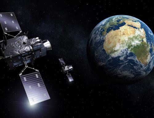
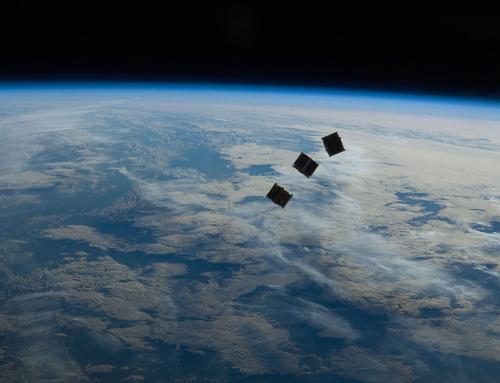
The in-flight assessment of the radiometric performances of space-borne instruments can be achieved by means of vicarious calibration over Pseudo-Invariant Calibration Sites (PICS).
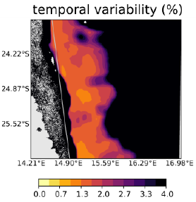
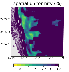
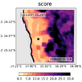
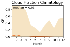
PICS are characterized by the temporal stability of their surface and atmosphere optical properties and by their spatial homogeneity.
PICS are characterized by the temporal stability of their surface and atmosphere optical properties and by their spatial homogeneity.
They are mostly sandy desert sites even though snowy or salty areas are also used. The first list of PICS over desert areas for the calibration of medium/coarse spatial resolution instruments was published 20 years ago using only six months of coarse Meteosat-4 data.
The 20 sites identified are located in the Saharan desert and in the Arabian Peninsula. Six of them have since been endorsed by the CEOS/WGCV/IVOS as reference Calibration/Validation test sites. Their radiometric properties aside, these Saharan sites have one major drawback: they are difficult to access logistically which hampers any attempt of ground truth characterization.
Project details
Categories:
Tags:
Share this project:
Identification of new sandy Pseudo-Invariant Calibration Sites (PICS)
NOVELTIS has done an analysis of satellite image time series in the optical range to identify new sites that could be used for on-flight calibration of satellites and the generation of a unique database of sand optical properties.
Project details
The in-flight assessment of the radiometric performances of space-borne instruments can be achieved by means of vicarious calibration over Pseudo-Invariant Calibration Sites (PICS).
PICS are characterized by the temporal stability of their surface and atmosphere optical properties and by their spatial homogeneity.
PICS are characterized by the temporal stability of their surface and atmosphere optical properties and by their spatial homogeneity.
They are mostly sandy desert sites even though snowy or salty areas are also used. The first list of PICS over desert areas for the calibration of medium/coarse spatial resolution instruments was published 20 years ago using only six months of coarse Meteosat-4 data.
The 20 sites identified are located in the Saharan desert and in the Arabian Peninsula. Six of them have since been endorsed by the CEOS/WGCV/IVOS as reference Calibration/Validation test sites. Their radiometric properties aside, these Saharan sites have one major drawback: they are difficult to access logistically which hampers any attempt of ground truth characterization.
It seemed necessary to verify that the 20 PICS identified 20 years ago are still relevant for on-flight calibration by means of up-to-date remotely sensed data, while identifying additional target sites more easily accessible.
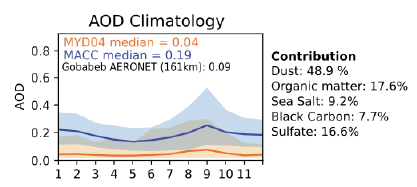
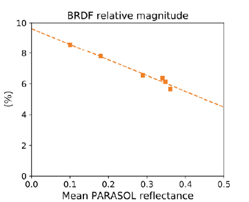
In addition, local scale characterization of surface hyperspectral/directional reflectance provides important constraints in order to support cross-comparison between space-borne sensors and may contribute to better understand the determinism of the spectral and directional variations of the surface reflectance depending on its mineral composition and roughness.
In addition, local scale characterization of surface hyperspectral/directional reflectance provides important constraints in order to support cross-comparison between space-borne sensors and may contribute to better understand the determinism of the spectral and directional variations of the surface reflectance depending on its mineral composition and roughness.
Means used
Results
We verified the still relevance of the PICS identified 20 years ago, in terms of the defined selection metrics, for on-flight calibration of optical imagers at medium and large spatial resolutions. Other possible opportunity targets have also been identified.
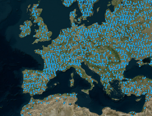
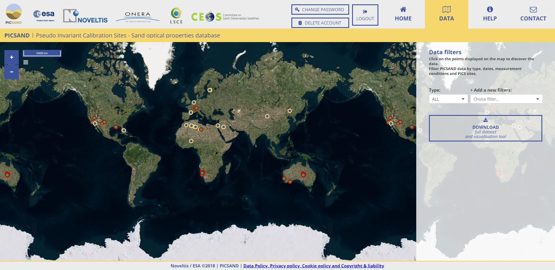
The PICSAND database, available at picsand.noveltis.fr, provides a free access to a compilation of laboratory and in situ measurements of sand spectral (400-2500 nm) and directional reflectance variations.