Database to simulate spectro-directional reflectance of the Earth surface
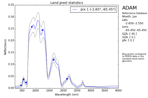
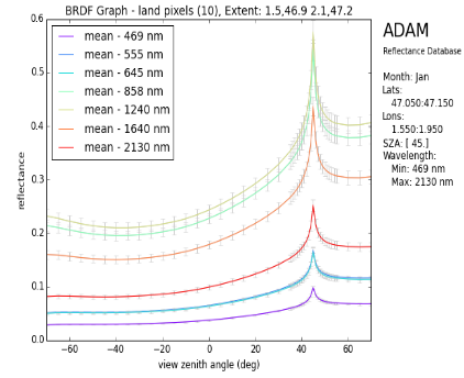
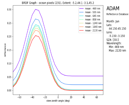
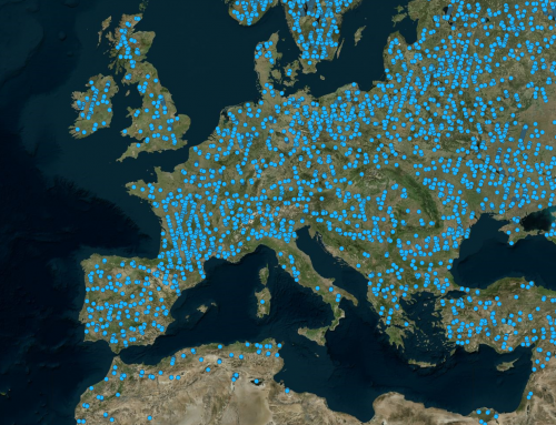
The ADAM climatological database and toolkit developed by NOVELTIS enable the calculation of realistic narrow-band reflectance values over the spectral 240-4000 nm range (at 1 nm spectral resolution) and in any observation geometry, at 0.1° x 0.1° (≈10 x 10km) spatial resolution.
In the optical spectral range, remotely sensed observations by satellite sensors are used to estimate several geophysical parameters characterizing the state of the atmosphere, ocean, and land surfaces. These observations are expressed in terms of “reflectance” of the target medium.
Earth surface reflectances are, to the first order, shaped by the absorbing properties of the surface constituents (e.g. photosynthetic and non-photosynthetic pigments for plant canopies and water surfaces, mineral composition for soils, water content, etc.). The surface reflectance also varies with the illumination and view geometry depending on the scattering generated by different “geometrical” factors of the medium considered (wave slopes for ocean surfaces which lead to a departure of the maximum reflectance from the “pure” specular direction surface roughness and canopy structure (e.g. volume and spatial distribution of leaves and crowns) which shape the directional signature of soil and vegetation reflectance. Indeed, the reflectance of most natural surfaces is largely anisotropic in the solar spectral range.
However, the directionality of the surface reflectance is often neglected in operational algorithms dedicated to atmospheric correction or characterization of atmospheric properties. There is therefore a need for accurate information on typical surface (Top-of-Canopy/Bottom-of-Atmosphere) reflectances, representing realistically the spectral and directional signatures of the Earth surfaces, in order to quantify the sensitivity of the retrievals to surface reflectance variability and to develop adaptation measures accounting for surface anisotropy.
Project details
Catégories:
Tags:
Share this project:
Database to simulate spectro-directional reflectance of the Earth surface
The ADAM climatological database and toolkit developed by NOVELTIS enable the calculation of realistic narrow-band reflectance values over the spectral 240-4000 nm range (at 1 nm spectral resolution) and in any observation geometry, at 0.1° x 0.1° (≈10 x 10km) spatial resolution.
Project details
Catégories:
Tags:
In the optical spectral range, remotely sensed observations by satellite sensors are used to estimate several geophysical parameters characterizing the state of the atmosphere, ocean, and land surfaces. These observations are expressed in terms of “reflectance” of the target medium.
Earth surface reflectances are, to the first order, shaped by the absorbing properties of the surface constituents (e.g. photosynthetic and non-photosynthetic pigments for plant canopies and water surfaces, mineral composition for soils, water content, etc.). The surface reflectance also varies with the illumination and view geometry depending on the scattering generated by different “geometrical” factors of the medium considered (wave slopes for ocean surfaces which lead to a departure of the maximum reflectance from the “pure” specular direction surface roughness and canopy structure (e.g. volume and spatial distribution of leaves and crowns) which shape the directional signature of soil and vegetation reflectance. Indeed, the reflectance of most natural surfaces is largely anisotropic in the solar spectral range.
However, the directionality of the surface reflectance is often neglected in operational algorithms dedicated to atmospheric correction or characterization of atmospheric properties. There is therefore a need for accurate information on typical surface (Top-of-Canopy/Bottom-of-Atmosphere) reflectances, representing realistically the spectral and directional signatures of the Earth surfaces, in order to quantify the sensitivity of the retrievals to surface reflectance variability and to develop adaptation measures accounting for surface anisotropy.
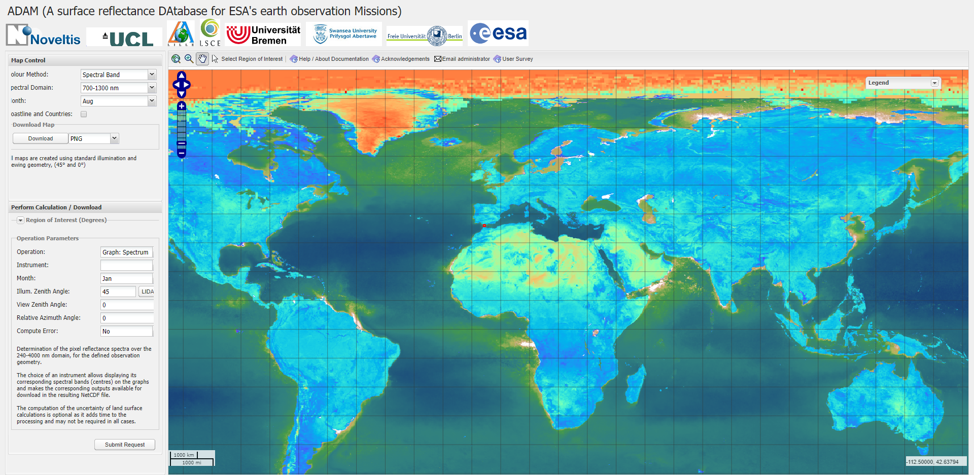
To be useful, a database of the Earth surface spectro-directional reflectance must cover wide spectral and directional ranges, whilst being of small size to facilitate manipulation.
In order to address these constraints, the approach relied on the development of a calculation toolbox which, for each Earth pixel, simulates the spectro-directional reflectance from a limited number of gridded satellite products,which are the basis of the ADAM database.