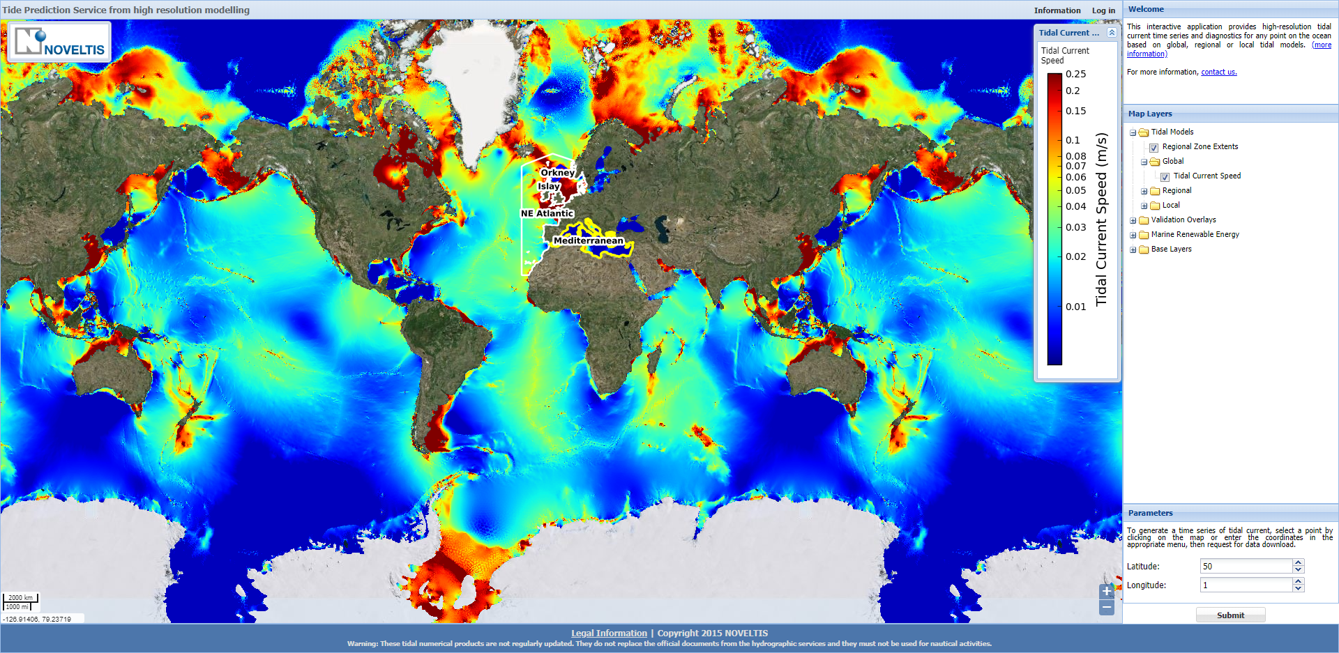
Web-service for tidal elevations and currents predictions
Accurate information about ocean tide currents is essential for renewable energy site assessment or evaluation of oceanic conditions for offshore implementation.
The TIPS website provides tidal information at two levels:
- Free demonstration product: one week of tidal currents on any point of the ocean, on a fixed period (January 2014)
- Paying service: 7/7 24/24 access to tidal currents and elevations on any period and any point of the ocean + additional diagnostics
Project details
Categories:
Tags:
Share this project:
Web-service for tidal elevations and currents predictions
Accurate information about ocean tide currents is essential for renewable energy site assessment or evaluation of oceanic conditions for offshore implementation.
The TIPS website provides tidal information at two levels:
- Free demonstration product: one week of tidal currents on any point of the ocean, on a fixed period (January 2014)
- Paying service: 7/7 24/24 access to tidal currents and elevations on any period and any point of the ocean + additional diagnostics
Project details
Categories:

Means used
NOVELTIS has implemented accurate high resolution tidal atlases on global, regional and local bases, using hydrodynamic modelling as well as the assimilation of tide gauge and satellite altimetry tidal observations.
This type of mesh is of particular interest in areas of steep topographic gradients, where the tidal currents generally show high variability, as well as in the shallow waters, where the energy dissipation is the highest, due to the bottom friction.