Fiducial Reference Measurements for Sentinel-3 and beyond
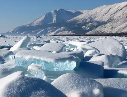
In the frame of the ESA St3TART-FO project, NOVELTIS leads a 20-partner consortium delivering Fiducial Reference Measurements (FRM) to support the calibration and validation of the Sentinel-3 SAR altimeter over inland waters, sea ice and land ice.
The Copernicus Sentinel-3 Surface Topography Mission (S3 STM) provides critical surface elevation information over sea ice, land ice and inland waters. These observations are made possible by its high-resolution synthetic aperture radar altimeter, a unique orbit reaching the polar regions up to 81.5°N, and a dual-mission constellation (S3A+S3B) providing a repeat cycle of around 15 days. Ensuring the reliability of these measurements requires comparing the mission’s geophysical retrieval methods, processing algorithms and corrections against independent, fully characterised reference measurements known as Fiducial Reference Measurements (FRM).
Building on the earlier St3TART project conducted by NOVELTIS (2021–2023), St3TART-FO establishes an operational framework for FRM, tackling the distinct challenges of three surface types: sea ice, land ice and inland waters. The project identifies and operates super and opportunity sites, acquires, processes and delivers FRM for Cal/Val activities, characterises the uncertainty of each FRM product, and prepares a roadmap for future altimetry missions beyond S3 STM, including CRISTAL and Sentinel-3 Next-Generation Topography.
Following a successful Operational Readiness Review in early 2025, St3TART-FO entered its operational phase, scaling up site coverage, automating FRM workflows and establishing robust routine data delivery to serve Sentinel-3 and future missions. Central to this effort is the FRM Data Hub, a free, accessible online platform providing traceable FRM datasets and open-source processing tools to the wider Cal/Val community.
Project details
Categories:
Tags:
Share this project:
Fiducial Reference Measurements for Sentinel-3 and beyond
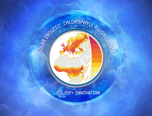
In the frame of the ESA-TROPOSIF project, NOVELTIS is in charge of elaborating and validating a new SIF product from Sentinel-5p data and of its exploitation to improve global scale simulations of carbon and water cycles with a terrestrial biosphere model (data assimilation).
Project details
Categories:
Tags:
The terrestrial biosphere plays a key role for climate by offsetting about one fourth of carbon dioxide (CO2) emissions released by anthropogenic activities into the atmosphere. Terrestrial ecosystems assimilate CO2 in leaf chloroplasts by photosynthesis, but most of the assimilated carbon is released back into the atmosphere (mainly as CO2) through ecosystem respiration. Our ability to characterize the spatial and temporal variations of carbon uptakes by land surfaces remains largely uncertain, and hence our ability to anticipate possible evolutions of terrestrial ecosystem functioning under a changing climate.
.
.
During the past decade, space-borne estimates of solar-induced chlorophyll fluorescence (SIF) have opened-up new prospects to improve our knowledge of the global carbon cycles. SIF is an electromagnetic signal emitted by the chlorophyll a of assimilating plants: part of the energy absorbed by chlorophyll a which is not used for photosynthesis emitted at longer wavelengths as a two-peak spectrum roughly covering the 650–850 nm spectral range. SIF responds instantaneously to perturbations in environmental conditions, which makes it a direct proxy for photosynthetic activity. However, SIF emission in only a slight fraction of the radiation at the top of the canopy, which is mostly made of reflected light.
Estimation of SIF from space-borne instruments is made possible by spectrometers initially dedicated to atmosphere characterization (green house gazes and trace gazes) because they provide the necessary spectral and radiometric sensitivity (e.g. GOSAT, OCO-2, GOME-2, SCIAMACHY).
Despite the great success of these satellites, the exploitation of SIF measurements for most applications is however limited by their coarse spatial resolution and low number of observations.
These limitations could be largely alleviated by the data provided by the TROPOMI instrument on-board Sentinel-5p: this instrument combines a high spatial resolution (3.5 km x 7 km at nadir), a large swath, and a daily revisit frequency, which enables a quasi-continuous sampling of the spatial and temporal variations of SIF at the global scale. The measurements also have a high signal-to-noise ratio and cover a large spectral range. These characteristics constitute a significant improvement in terms of accuracy and number of data available daily compared to those provided by previous missions.
Despite the great success of these satellites, the exploitation of SIF measurements for most applications is however limited by their coarse spatial resolution and low number of observations.
These limitations could be largely alleviated by the data provided by the TROPOMI instrument on-board Sentinel-5p: this instrument combines a high spatial resolution (3.5 km x 7 km at nadir), a large swath, and a daily revisit frequency, which enables a quasi-continuous sampling of the spatial and temporal variations of SIF at the global scale. The measurements also have a high signal-to-noise ratio and cover a large spectral range. These characteristics constitute a significant improvement in terms of accuracy and number of data available daily compared to those provided by previous missions.


Means used
Results
Client / Partner(s)